Wilmot Creek Neighbourhood Secondary Plan

Project description

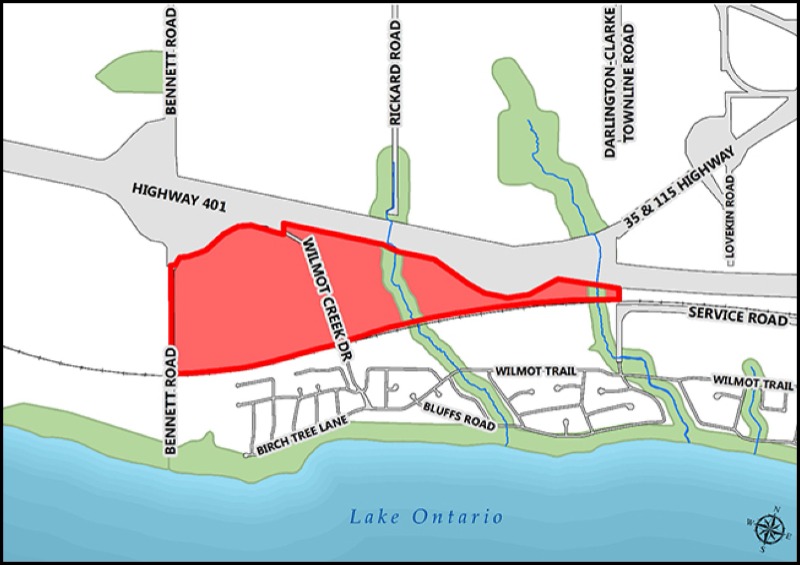
The Municipality of Clarington has created a new secondary plan for the lands south of Highway 401 and north of the existing Wilmot Creek Adult Lifestyle Community.

This secondary plan creates an environmentally sustainable and healthy community with liveable neighbourhoods, integrated and connected green spaces, efficient transportation and trail systems, and a vibrant commercial area. The secondary plan area is intended to be a safe and inclusive pedestrian-oriented community that supports walkability and active living with accessible amenities. These secondary plan policies and sustainability guidelines do not apply to the existing Wilmot Creek community.

Wilmot Creek Neighbourhood Secondary Plan

The Wilmot Creek Neighbourhood Secondary Plan is now in effect. The final and approved Secondary Plan and Sustainability Guidelines are available below.

On October 23, 2024, the Wilmot Creek Neighbourhood Secondary Plan (OPA 130) was approved by the Region of Durham with minor modifications

The staff recommended Wilmot Creek Neighbourhood Secondary Plan was presented to the Planning and Development Committee on April 24, 2023, and adopted by Council on May 1, 2023. 

Background reports which have been produced or updated since the October 25, 2021, Statutory Public Meeting are available upon request:

  • Traffic Impact Study (April 2022)
  • Noise Feasibility Study (May 2022)
  • Master Water & Wastewater Servicing & Floodplain Analysis Report (April 2023)
  • Preliminary Sizing of Stormwater Management Facilities (February 2023)

Previous Project updates

Public consultation

  • Wilmot Creek Neighbourhood Secondary Plan Summary Report (PDF) (October 2019)
  • Active Transportation Analysis (October 2019)
  • Water and Wastewater Servicing Plan (June 2020)
  • Floodplain Analysis and Stormwater Management Plan (October 2019)
  • Landscape Analysis (October 2019)
  • Sustainability Background Report (October 2019)
  • Urban Design Analysis (October 2019)
  • Hydrogeological Investigation and Water Balance Study (October 2019)
  • Existing Environmental and Geomorphological Conditions Report (October 2019)
  • Air Quality Assessment (December 2018)
  • Archaeological Assessment (February 2019)
  • Geotechnical Investigation (December 2018)
  • Traffic Impact Study - Existing Conditions Assessment (October 2019)
  • Noise and Vibration Study (2015)

On April 15, 2021, the Municipality hosted a virtual Public Information Centre (PIC), to provide an update to residents on the status of the Wilmot Creek Secondary Plan project. Based on feedback from the first PIC, and the supporting technical analysis, three development options were created that have led to an emerging plan.

The materials presented at the April 15, 2021, PIC are located below.

On July 26, 2018, the Municipality hosted the first Public Information Centre (PIC) for the Wilmot Creek Secondary Plan. The purpose of the PIC was to introduce the process the Municipality is undertaking to develop a Secondary Plan for the final phases of the Wilmot Creek Community. Approximately 400 people attended the meeting, the majority of whom are residents of the existing Adult Lifestyle Wilmot Creek Community.

Read the summary report to learn more about the feedback received at the Public Information Centre.

The materials presented at the July 26, 2018 PIC are located below.

The public meeting was held Monday, December 4, 2017 at the Municipal Administrative Centre.

The Public Meeting Staff Report, including draft Terms of Reference for the Secondary Plan, was presented to Council on December 4, 2017.

File number

  • COPA 2021-0005 (PLN 41.1)

Stay informed and get involved

  • Subscribe below to receive email notification when this page is updated with upcoming meetings and reports.
  • Get in touch with project management staff: Lisa Backus, Manager Community Planning, 905-623-3379 ext. 2413.

Contact Us

Address: 40 Temperance Street, Bowmanville, ON L1C 3A6

Phone: 905-623-3379
TTY: 1-844-790-1599